The fishing harbour
 i
iThe term ‘fishing harbour’ covers the areas bordering the north-westernmost harbour basin.
These areas are primarily used for leisure activities and lighter, public-facing businesses, although a few heavier industries are still present.
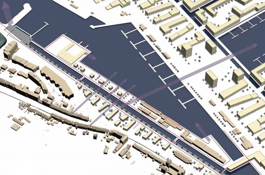
In connection with the tender for the Vestgrunden site, the local authority has published a preliminary draft master plan for the area. The proposal should be regarded as the administration’s initial draft plan and is being circulated as a source of inspiration for the architectural firms wishing to tender for the Vestgrunden site.
In connection with the drafting of a local plan for the Vestgrunden site, the master plan will be considered both politically and publicly.
The plan is generally conservation-oriented, but there will nevertheless be a number of buildings at risk.
Thus, both Søsporten and all the buildings west of Fiskerivej are situated on land which, according to the plan, is to be cleared to make way for canals. However, both the longitudinal canal and the canal through Søsporten are only the main alternatives, and alternatives that do not include these canals are also included in the plan. To compensate for these areas, a basin immediately south of Træskibshavnen is expected to be filled in and used for rowing and diving clubs, as well as for winter storage.
In addition to the creation of these canals, the plan comprises a number of new building plots. In general, it is stipulated that buildings may have a maximum footprint equivalent to 30 per cent of the plot area, and that all buildings may be no more than two storeys high.
 i
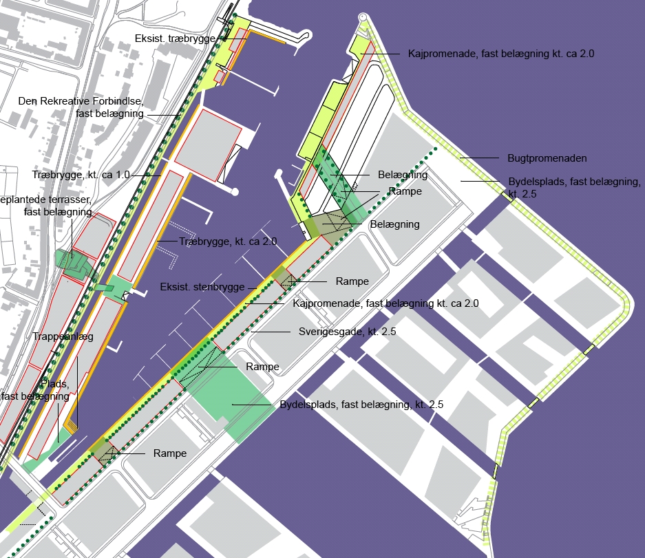
iTo make room for the recreational route that is to run along the entire coastline, it is necessary to move the Grenå railway line a few metres to the side. However, this still leaves some space between the railway line and Skovvejen, and it is intended that a number of houses be built here.
Roughly where the steps over the railway line are located today (by the fishmongers), a rather interesting structure has been envisaged, with terraces stepping down towards Fiskerihavnen. As well as spanning the Grenå railway line, the structure is to include sports facilities and car parking.
In addition to the aforementioned bridge over the railway line, the plan also includes another bridge, namely between the western and eastern sides of Fiskerihavnen. However, it has not yet been clarified how the bridge is to be designed without obstructing the passage of tall-masted ships.