Recreational Vision for the Aarhus River
 i
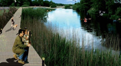
iIn its 2008 Planning Strategy, Aarhus Municipality has set out a plan to make even greater use of the recreational value of the Aarhus Å than is currently the case. This is to be achieved by progressively making the areas around the stream accessible and by supporting the natural diversity offered by the stream’s course.
Aarhus was born of the river, and throughout history the river has played a major role in the city’s development. In the early centuries, it was the river’s fresh water that made Aarhus the obvious choice for a settlement by the sea, whilst later it was the water’s defensive qualities and the sheltered river harbour that drove the city’s development.
Throughout the nineteenth and twentieth centuries, the availability of water supply and sewage disposal in particular became a key factor in attracting many large companies to locate in the city. In the latter half of the twentieth century, the central sections of the river then became a land reserve, enabling the construction of a new main road to the harbour – Åboulevarden, of course.
By the end of the twentieth century, the stream had lost its significance for the city’s industries, and attention began to turn to its recreational value. This marked the start of the city’s most significant regeneration project in recent times: the uncovering of the stream. With the exposed stream running through the city centre, a new leisure precinct emerged across the old shopping district, and city life around the stream is now one of the city’s most distinctive attractions.
The first section of the stream’s uncovering has since been followed by further stages, and today only the stream’s mouth at Aarhus Harbour remains covered. The opening of this section is already planned to take place in coordination with the redevelopment of the harbour areas close to the city centre.
In addition to the beautification of the areas around the inner river, several million is currently being spent on improving water quality in the Aarhus River, and consequently in Brabrand Lake, Aarhus Harbour and the Bay.
The aim is to reduce the discharge of wastewater into the river, with the objective of achieving a water quality that will make the lake, the river and the harbour suitable for water sports and bathing.
Discharges are being reduced by connecting the few remaining small sewerage systems to the city’s efficient treatment plant, as well as by establishing Forsinkelsesbassin ved Carl Blochs Gade to prevent rain-induced discharges.
The situation today is therefore that the stream’s accessibility and recreational value are well utilised in the city centre and, to some extent, around Brabrand Lake. In contrast, the stretch of the stream between Thorvaldsensgade and Ringvejen is characterised by the city having ‘turned its back on the stream’, and long stretches of the stream are inaccessible due to adjacent industrial estates or railway land.
However, large parts of these areas are currently undergoing regeneration. Thus, the area around the old Godsbanegård, the Ceres site and virtually the whole of Søren Frichs Vej are currently being considered as urban regeneration areas.
In this context, the local authority has drawn up a vision for the stream, which is intended to ensure that the planning of the individual areas takes into account the desire for a continuous recreational watercourse between the harbour and Brabrand Lake.
The plan divides the stream into three sections: the urban stream, the urban regeneration stream and the landscape stream.
For each of these three ‘streams’, a range of activities is described which the stream’s surroundings are intended to support. A recurring theme is accessibility in the form of footpaths and bridges, but there is also a desire for the river to once again be navigable by small vessels all the way from the town to Brabrand Lake. Whether the stream is to be navigable all the way to the harbour has not yet been finally decided; if so, this would also mean that the drop at the old lock bridge would have to be moved to a location where mooring points could be established.
This vision forms part of the draft for the 2009 Municipal Plan, and it is expected that the recreational use of the stream will be one of the objectives in the forthcoming municipal plan.
In addition to the description of the vision in the case study booklet for the 2008 Planning Strategy, a leaflet has previously been published on the master plan for the stream between Mølleparken and Stenhuggergrunden.