Planning Strategy Post: New Transport Plan for South Aarhus
The following has been submitted as a contribution to the debate on the Planning Strategy
I hereby propose that, in connection with the Planning Strategy, an updated traffic plan for the city centre be drawn up, taking into account the many new ideas.
The following should be seen as a contribution to this work. The proposal is a summary of previously suggested plans and ideas that have been raised in the debate. I have focused solely on the southern part of the city centre, as this is where I see the greatest conflicts between the current traffic plan and forthcoming projects.
A new traffic plan for the southern city centre should be based on the following objectives:
- Fast and efficient access for cars to the city centre’s local traffic zones and parking facilities
- High-quality public transport, in dedicated lanes and with limited crossing traffic
- Making central shopping streets and historic high streets pedestrian-friendly
- Safe and efficient routes for vulnerable road users, separated from heavy traffic
- Construction of a roundabout or similar traffic facility at Frederiks Bro. If the railway cutting is covered over, the roundabout can be built at the same level as a multi-storey car park below street level.
- The roundabout must connect Værkmestergade (via ramps) with Frederiks Alle and a new road, ‘Godsbanegade’, towards Carl Blochs Gade.
- Construction of a “parking ring” from Godsbanegade via Sonnesgade, Marstrandsgade, Åboulevarden and the tunnel to the multi-storey car park beneath Telefontorvet. From here, a (one-way) exit will be created to Fiskergade, providing access to the Sallings car park and the future car park at the harbour’s southern bastion. Via Spanien, there will be access from here to Værkmestergade and the wider road network.
- Vester Alle, Thorvaldsensgade, Park Alle, M.P. Bruuns Gade and Ny Banegårdsgade will be adapted for public transport in accordance with the light rail plans, whilst ensuring that vulnerable road users can still use the roads.
- The innermost section of Frederiks Alle will be made entirely pedestrianised to create greater continuity between the two large urban parks, Musikhusparken and Rådhusparken.
- The outer sections of Frederiks Alle and Jægergårdsgade will be made pedestrianised to the extent that their function as local distribution routes permits.
- Sønder Alle will be made pedestrianised as part of the redevelopment of the area around the coach station.
- To the extent that the main access route to the Sallings car park can be relocated to Fiskergade, J.M. Mørks Gade and Østergade will be made quieter.
- The section between Mølleparken and Voxhall/Huset will be made pedestrianised to the extent possible and will form part of a recreational route along the stream. The route will continue along Thorvaldsensgade and connect to Brabrandstien.
- The section of Værkmestergade running through the railway cutting will be extended to the junction of Christian X’s Vej and Skanderborgvej.
- Freight train services on the new light rail lines will be moved to a new link between the main line and the Grenå Line, established alongside the Søften–Skødstrup motorway.
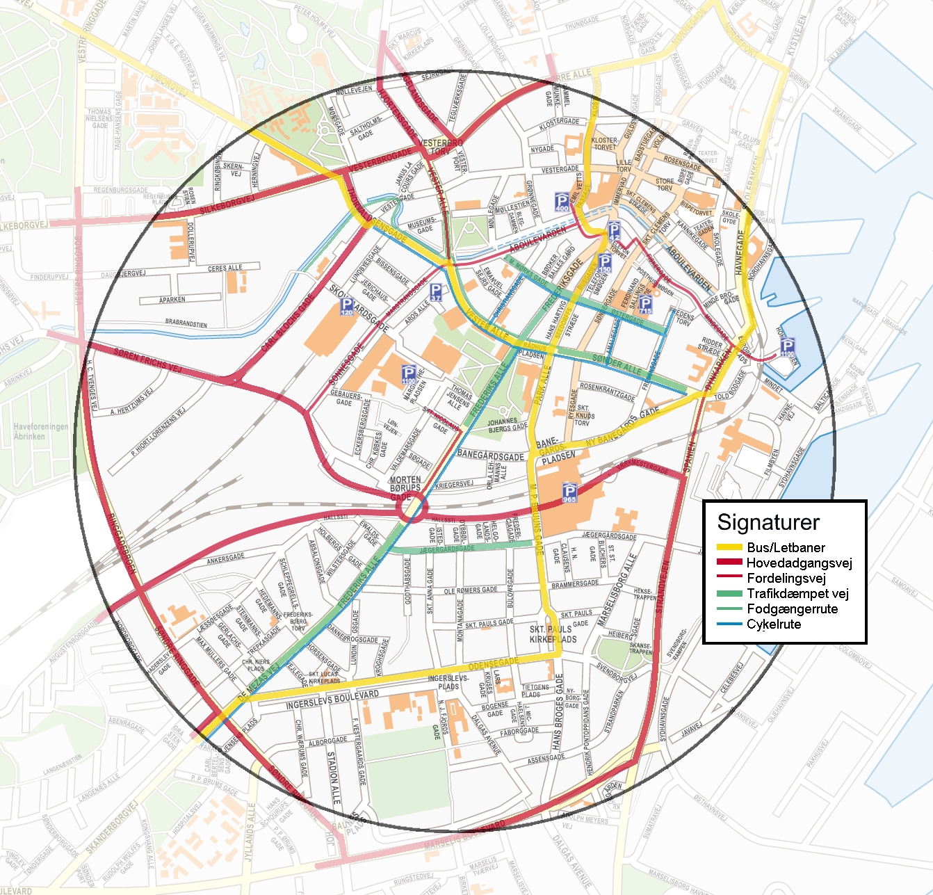
The map below shows the changes to the primary functions of the main lines.
 i
iI shall now elaborate on the individual components:
Two projects in particular will affect city centre traffic over the next 20 years:
The light rail project, which is expected to close several major roads to car traffic
The railway cutting cover, which will provide new opportunities for traffic flow across the railway cutting
Vester Alle will be closed to car traffic
The central route of the light rail was established in the 2000 light rail report, and subsequent reports have not significantly altered these original plans. The original report recommends a western approach via Viborgvej, the Ceres junction, Thorvaldsensgade and Vester Alle.
The report assumes that all traffic via Vester Alle will be diverted to a future road in the tram cutting, which will connect the central workshop areas with Carl Blochs Gade via Frederiks Bro. As is well known, Værkmestergade was instead routed entirely south of the railway line.
Should a western access route via Vester Alle be retained, it will be very difficult to maintain the same traffic capacity for cars. There is a theoretical possibility of squeezing in a single carriageway in each direction, but this would probably require the use of open spaces around ARoS and the historic buildings north of Vester Alle, including the courthouse. Even if it were possible to make room for a traffic lane, this would probably be neither appropriate for car traffic nor for light rail traffic.
It is therefore recommended that the proposal to close Vester Alle to car traffic and establish a new road between Frederiks Bro and Carl Blochs Gade be maintained.
New road – Godsbanegade
Between Frederiks Bro and Carl Blochs Gade, there are residential and commercial properties, as well as DSB’s maintenance facilities. However, the largest area is the freight railway site, which has already been purchased by the local authority. As part of the railway cutting cover and the development of the freight railway project, it is recommended that a link be established between Frederiks Bro and Carl Blochs Gade. This link is referred to here as Godsbanegade.
Godsbanegade’s connection to Carl Blochs Gade provides a good link to the new urban regeneration areas and Vesterbro Torv. On the upper section of Thorvaldsensgade, the 2000 light rail report assumes that a retail building will be demolished to make way for both the light rail line and the main access road. The lower section of Thorvaldsensgade, on the other hand, is expected to become a one-way street running northwards.
The P-ring
 i
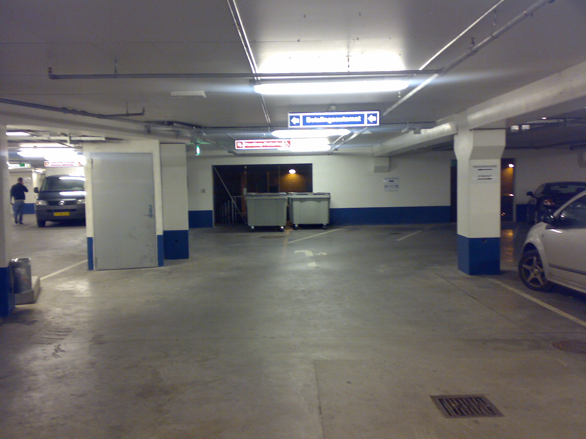
iTo avoid creating unnecessary detours and confusion for visitors to the city, it would make sense to establish a parking ring providing a direct link from Godsbanegade to the city’s main car parks.
Such a ring could be established by reopening Marstrandsgade, ideally as a two-way street, but possibly as a one-way street in the direction of Åboulevarden.
Along this section, the loop would provide direct access to car parks at the Scandinavian Congress Centre, Godsbanegården, ARoS, as well as the car parks at Magasins, Telefontorvet and Busgade.
If the loop is to be completed, an exit will need to be created from the Telefontorvet car park to Fiskergade. The Telefontorvet car park is almost 20–30 cm level with Fiskergade, and to allow direct access to it, it will only be necessary to remove one parking space in the Telefontorvet car park, the removal of 1–2 parking spaces in the TDC car park, the relocation of a fence, and the construction of a short ramp. The project naturally requires the cooperation of private parties (unless compulsory purchase is resorted to), but it would allow for better utilisation of the (expensive) municipal tunnel to the Telefontorvet and Busgade car parks, whilst also reducing the risk of queues when the Magasin car park is full.
From Fiskergade, there is direct access to the Sallings car park, this time via a tunnel under Posthussmøgen.
From the Sallings car park, there is a (one-way) exit via Mindegade, as is currently the case. The future southern bastion car park is also situated with direct access from the P-ring.
The P-ring is completed by directing traffic along Dynkarken and Spanien to Værkmestergade or Marselis Boulevard.
Public transport route via Ny Banegårdsgade
The 2006 Light Rail Report sets out two options for an eastern light rail route at street level from Banegårdspladsen to the harbour railway. One option is via Sønder Alle, which buses currently use, and the other is via Ny Banegårdsgade. The report recommends Ny Banegårdsgade, and it must be assumed that this recommendation is being taken into account in the work currently underway regarding a new bus station close to the railway station. If the bus station is relocated to a deck above Banegraven (as envisaged in the County Council’s plans) and the light rail route follows the current route of Ny Banegårdsgade, then Sønder Alle could be preserved for pedestrian and cycle use only.
Making the inner sections of Frederiks Alle and Sønder Alle car-free
Closing Vester Alle will divert a significant number of motorists away from Frederiks Alle, and the switch from bus services to light rail will remove public transport from the area as well.
The establishment of a parking ring would make it possible to close the problematic access to the Salling car park from Sønder Alle.
On the stretch between Frederiks Bro, Frederiks Alle and Sønder Alle, the only traffic remaining will be that heading for the inner harbour, as well as local traffic around the surrounding streets. As for through traffic, however, for the vast majority it will be more attractive to use a direct link from Frederiks Bro to Spanien, which can be established by extending the eastern section of Værkmestergade up to a roundabout at this point.
These measures will make it possible to make the inner section of Frederiks Alle, most of Sønder Alle, and even more of the streets within the Allegaderingen area car-free.
Making the central section of Frederiks Alle a pedestrianised zone has long been a topic of debate, to such an extent that tunnelling has even been proposed. Although Aarhus will have considerable experience with road tunnelling in 10 years’ time, such a project would likely be far more expensive than the benefits would justify.
Recreational use of the stream
 i
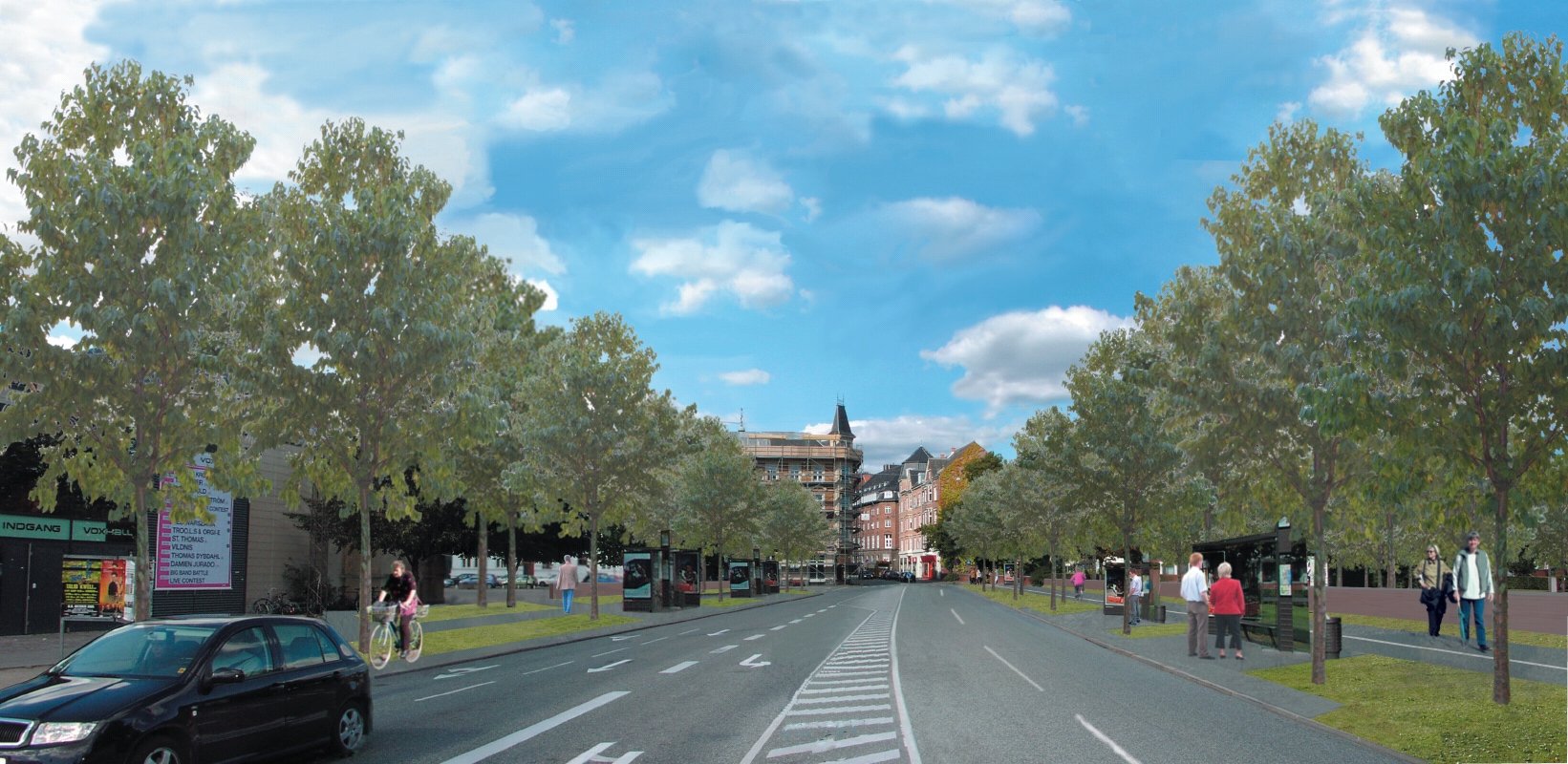
iThe planning strategy already includes a proposal for the recreational use of the Århus Å. I can only endorse this vision and urge a holistic approach, so that the city’s residents and visitors can follow natural walking routes (e.g. along the stream) without dead ends, and so that the surroundings along the entire route are enhanced over time. Aarhus is a city shaped by the bay and the river, and this should be evident throughout the cityscape.
If Vester Alle and Thorvaldsensgade are closed to motor traffic and the P-ring is established, traffic along Vester Alle on the stretch between Mølleparken and Huset will be very limited.
It is therefore possible to link these open, recreational areas even more closely. Furthermore, Brabrandstien can be extended even further towards the city centre, effectively all the way to Mølleparken.
Extension of Værkmestergade
The creation of an efficient transport hub at Frederiks Bro will, via Værkmestergade, provide good access from the southern approach roads. If the Odderbanen tracks are freed up by the relocation of the light rail to Skanderborgvej, Værkmestergade can be extended all the way to where Christian X’s Vej passes under Skanderborgvej. At Åhavevej, the crossing can be either at-grade or grade-separated, as discussed in the report on the Marseli Tunnel; in the latter case, with ramps down to Åhavevej.
The project will thus provide all south-western approach roads (E45/Åhavevej, Skanderborgvej, Christian X’s vej) with direct access to a fast and efficient traffic corridor right into the heart of Aarhus.
Traffic calming on the outer sections of Frederiks Alle and Jægergårdsgade
Effective southern links to Aarhus City will make it feasible to implement traffic-calming measures along the outer sections of Frederiks Alle and Jægergårdsgade, ranging from speed reductions to closures at, for example, Max Mullers Gade.
Traffic calming should be viewed as a long-term objective and is therefore not in direct conflict with the project already underway on this stretch, which will be of great benefit in the short and medium term.
New freight link between the main line and the Grenå Line
 i
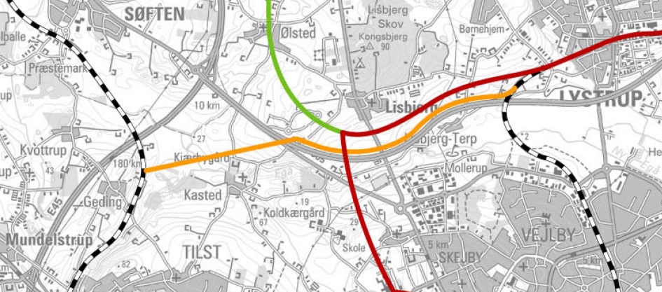
iThe 2005 light rail report proposes establishing a new freight rail link between the main line and the Grenå Line. The freight line is proposed to be built between Geding and Lystrup, so that it follows the new motorway between Søften and Skødstrup. The route has been reserved in the Lisbjerg development plan.
Should such a freight line be established, the light rail section in central Aarhus could be downgraded entirely, thereby further reducing the barrier effect between the city and the port.