Master plan for the area around the bus station
 i
iIt has long been recognised that the current coach station has a number of drawbacks.
The coach station is too small for all long-distance coaches to depart from here; consequently, some tourist coaches and, previously, the coach to Copenhagen have had to use the Musikhuset.
At the same time, the location of the coach station is inconvenient for passengers needing to change from city buses or trains.
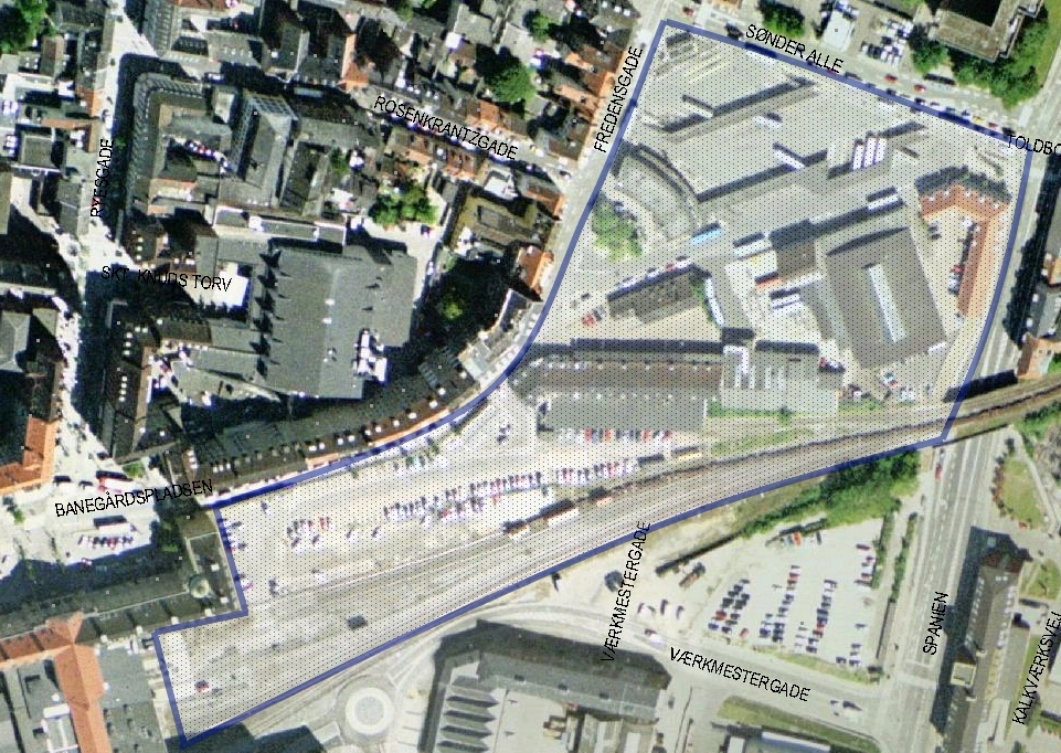
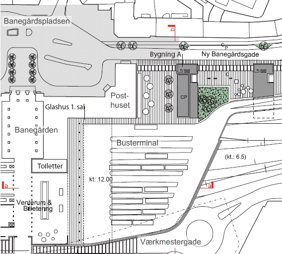
There has therefore long been a desire to establish a new coach station close to Aarhus Central Station by covering part of the railway embankment, and work is currently underway on a master plan for the area bounded by the railway line, Aarhus Central Station, Ny Banegårdsgade, Fredensgade, Sønder Alle and Spanien.
As early as 1997, plans were being drawn up to relocate or expand the coach station. Even then, there were plans to refurbish the coach station to accommodate modern traffic management, with buses departing from dynamically allocated bays rather than fixed stops.
At the time, an on-site expansion was considered, or alternatively a move to Banegårdspladsen.
However, an on-site expansion did not solve the problem of transfers, and Banegårdspladsen does not have enough space for bays and depot areas, which would result in a significant amount of empty runs.
The plans then stalled for a few years.
The 1999 infrastructure report once again emphasised the need to improve terminal facilities around Aarhus H.
In the spring of 2000, the local authority set up a working group comprising representatives from DSB, the Danish Rail Authority, Aarhus Coach Station, Aarhus County and Aarhus Municipality. The working group proposed establishing the coach station on a concrete deck spanning the tracks to the east of Aarhus Central Station.
 i
iHowever, the proposal was delayed due to disagreements over access arrangements. In 2005, a number of parties reached an agreement to resume work, this time in connection with the new transport plan for the city centre.
Work then apparently ground to a halt once again until the light rail report was published at the end of 2006.
The later stages of the light rail project require the line to be moved from its current route from Odder to Grenå, and raised to street level, so that at the junction with Skanderborgvej, the Odder Line runs along a street route into Skanderborgvej, via Frederiksbjerg, over Bruuns Bridge, through Banegårdspladsen and via Ny Banegårdsgade towards the harbour track.
At the coach station, the track can either be routed south of the station or north via Fredensgade and Sønder Alle, but this route is not recommended as space is limited here.
It therefore became clear that the original master plan no longer covered the whole area, but that the layout of the area needed to be rethought, taking into account the light rail’s dual route down to Dynkarken and further north.
In this context, the councillor responsible stated that the municipality’s Department of Technology and Environment would draw up such a master plan, which is currently awaited.