Aarhus Light Rail
 i
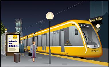
iThe light rail is Aarhus Municipality’s vision for the future of public transport infrastructure.
It is the largest investment in public transport in the city’s history, and the project will bring the tracks back to Aarhus Sporveje.
The grand vision includes routes to most of the towns in the Aarhus Municipality catchment area and several neighbouring municipalities, and the central parts of Aarhus will be well served by light rail tracks along the harbour, on the bus corridor, and on Vester Alle.
The ultimate goal lies 20 years in the future, but work is already underway on an environmental impact assessment for the first phase, which is to run from the Grenåbanen line at Nørreport, up Randersvej, past Skejby Hospital, through Lisbjerg and then rejoining the Grenå Line at Lystrup.
The government has provided funding for the EIA, and several national politicians have spoken positively about state co-funding of the light rail scheme; however, MidtJylland Region’s transport company, MidtTrafik, is also involved in the project. The region and the municipalities concerned have set up a joint secretariat to work towards the project’s realisation.
The first phase is estimated to cost DKK 715 million for approximately 12 km of track. This cost includes, amongst other things, two bridges, so that Søftenvej and the Djursland Motorway can be crossed at different levels.
 i
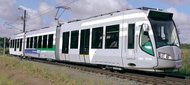
iThe remaining phases are expected to have a total construction cost of 1.5 billion kroner. In addition to this, depots will need to be built and rolling stock purchased (50 train sets at DKK 20 million each are anticipated), but these costs, like bus operations, are expected to be financed through the operating budget.
Overall, the Light Rail is expected to be more cost-effective to operate than buses; in addition, there will be savings on road investment as more people use public transport, as well as a better environmental footprint due to the Light Rail’s partial use of electricity.
The Light Rail’s energy supply, in particular, is expected to be somewhat unique for many years to come. On the inner, newer sections of the network, trains will run on electricity to minimise harmful particles in the city air. On the older sections in open countryside, trains will continue to run on diesel. So-called dual-mode trains are a relatively new invention, but there are already railways in Germany operating such rolling stock.
 i
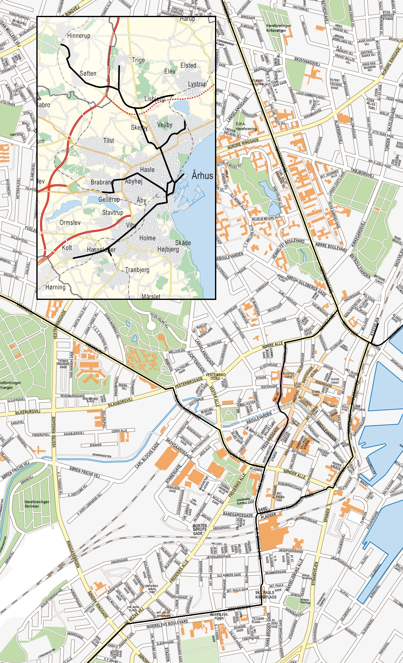
iThe final route of the light rail system is to be determined in the EIA study and the subsequent debate, but the reports drawn up have already outlined the broad contours of the route through the city. Thus, the plan for phase one is to establish a double track from Aarhus H to Nørreport, after which the line splits so that the double track continues up Randersvej, whilst a single track still connects to the line through Risskov. The line along the harbour is envisaged as a central reservation, but the final design (including how to make room for an extra track on the bridge over Spanien) has not yet been finalised.
The line will then continue along Randersvej until it turns onto Nehrus Allé to pass Skejby Hospital and then continue on its own right-of-way towards Lisbjerg.
The remaining stages are also outlined in the 2006 report. The plan here is for Banegårdspladsen to become the major transport hub, whilst the entire bus corridor is to be served.
In the long term, a track is therefore to be established from Nørreport, via Nørregade, Klosterport, Emil Wetts Passage, Busgaden, Park Alle, M. P. Bruunsgade, Odensegade and Ingerslevs Boulevard to Skanderborgvej. Here, the line will continue along Skanderborgvej as a street-level route to Hasselager, where it will connect with the Odderbanen line, as well as continuing towards Kolt and Bering. It is therefore possible that the Odder Line’s track from Hasselager to Aarhus H could be phased out.
At this stage, the connection to the Grenå Line is expected to be moved from Aarhus Central Station to Banegårdspladsen, so that trains can run directly from M. P. Bruunsgade, across Banegårdspladsen, via Ny Banegårdsgade and Dynkarken to the harbour line.
A light rail service to the new urban areas at Nordhavnen is also outlined, via a track from Nørreport and out along Bernhard Jensens Boulevard, which will become Kanalbyen’s central transport artery.
Finally, a westbound route is outlined which branches off the Busaksen at Rådhuspladsen, runs along Vester Alle to the junction with Åboulevarden, and continues via Thorvaldsensgade and out along Viborgvej. At Ryhaven, the route then turns south-west to serve the residential area around Gellerup before continuing a short distance along Silkeborgvej. There is currently debate as to whether the route should be extended all the way to Silkeborg.
In northern Aarhus, routes are being planned to connect the light rail system with Vejlby, Trige, Hinnerup and Søften. Via the existing rail network (which may be expanded), the line could also be extended to Hadsten, and even Randers has expressed a desire for a connection.
As can be seen, the plans are ambitious, but planning is already underway to realise them. Consequently, the Busgade underpass and the bridge over the stream have been designed to accommodate light rail trains.
Work is currently underway to establish bus lanes on Randersvej. This requires widening the road profile to accommodate two lanes of traffic and a bus lane (later to become a light rail track) in each direction. The general plan is to begin introducing bus lanes on the roads where the light rail is eventually to run.
Finally, it is worth noting that the architectural competition launched for the area around the old ferry pier stipulates that the project must incorporate both the multimedia centre and the harbour area, as well as tram tracks, road lanes and connections for pedestrians and cyclists.